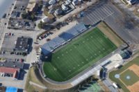
FROM THE SOUTH
Travel 95 North
Take Exit 16 toward Elmwood Avenue.
Follow signs for Roger Williams Park Zoo.
At bottom of hill take a left at the light onto Elmwood Avenue.
Follow through one set of lights.
Park Entrance is within 100 feet on right hand side.
Within the park follow signs to tennis courts, sometimes referred to as other attractions.
Courts are just past the zoo on the left.
FROM THE NORTH
Travel 95 South.
Take Exit 17 and Bear left off the exit.
Take left at the light onto Elmwood Avenue.
Proceed through 1 set of lights.
Park Entrance is immediately on left-hand side.
Within the park follow signs to tennis courts, sometimes referred to as other attractions.
Courts are just past the zoo on the left.
Visit: http://www.spotri.com for More Information

From 95N
95N to Exit 16 (Rte 10) to Elmwood Ave Exit. Bottom ramp take right. Continue to light at Park Ave. Left to next light. Right on Park View Blvd. School on right.
From 95S
95S to Exit 16 (Rte 10) to Park Ave East. Left at light. Right at next light. (Park View Blvd). School is on right.
Traveling North to Providence
Route 95 North to State Offices Exit (#23) – Turn Right onto Orms Street and then Right onto Smith Street (Route 44) – Go Approximately 1.5 miles go through stop light at Academy Avenue and take left into Field House Parking lot (across from Mobile Station). Countinue down access road behind field house to athletic field parking lot.
Traveling South to Providence
Driving Route 95 South, take Charles Street Exit (Exit 23) off Route 95. Turn right at the end of the ramp onto Charles Street. Turn left at traffic light and proceed on Admiral Street. There will be a Dunkin Donuts on your left. Stay on Admiral until River Avenue. Take a left onto River. Proceed to Eaton Street light. Take a rigth onto Easton. Stay on Eaton Street until it meets Smith Street. Entrance to La Salle is right there.
Traveling North or South on Route 295
Take the Route 44 East Exit off of Route 295. Stay on Route 44 though North Providence until you come to La Salle. Entrance will be on your right.
Cranston High School West
95N or 95S to Exit 14 to Route 37W. Go to end. Take right on Phenix Ave for approximately 1.2 miles. Right onto Metropolitan Ave. for the tennis courts and gym. Continue on Phenix Avenue for outdoor fields. An AED is available in the main foyer of the gym if needed.
Ice Rink – Hockey
95N or 95S to Exit 14 to Route 37W to end. Right on Phenix Avenue. Rink is on right less than 1/4 mile.
From Route 95
From Route 95 North or South, exit at Route 37 East in Warwick. Follow Route 37 towards Post Road (Route 1). Take Post Road North (all the way to the end of Route 37). Stay on Post Road North for about 2 miles until you come to the intersection of Fairfax Drive on the left. There will be a Dunkin Donuts just ahead on the right. If you go pass Dunkin Donuts, then you missed your turn. Take a right onto Fairfax Drive (bear right as you enter the neighborhood) and stay on it for about one mile. The first major intersection will be Pilgrim Drive on the left. Take a left onto Pilgrim Drive. The school is on the left. The baseball and soccer field is to the right of the school. The football field is behind the baseball field. The gym is in the back of the school.
From the west, north or south
Take 95N or 95S to 195 East across the Washington Bridge. Take the Broadway exit off 195 East. At the end of the exit take a left onto Warren Avenue. At the first major intersection take a left onto Pawtucket Avenue. Travel through one intersection and you will come to the entrance to EPHS on the right hand side just past the Dickerman Diamond and Fieldhouse of PCD.(Note: AED on site)
From the east
Take 195 West to the East Providence Exit. At the end of the exit take a left onto South Broadway. At the first intersection take a left onto Warren Avenue. Travel Warren avenue until you come to the intersection of Warren and Pawtucket Avenues. Take a left onto Pawtucket Avenue. Travel through first intersection and the entrance to EPHS will be on your right just past the Dickerman Diamond and Fieldhouse of PCD.
From Points South, North and West:
Rte 95 to 195 East to Exit 6 – Broadway / Warren Avenue
At end of short ramp, turn right onto Warren Avenue
Proceed 1/4 mile to light and intersection with Broadway
Turn right at light onto Broadway heading North
Continue heading North for approximately 2 miles, using underpass beneath Rte. 44
Continue heading North and pass signs for the East Side of Providence / Henderson Bridge
Continue for 1/2 mile through 2 more lights (1st light intersects Massasoit; pass Dunkin Donuts on left; 2nd light intersects Centre Street on right and Roger Williams Parkway on left)
Just past intersection of North Broadway and Centre Street ; golf pro shop, parking and bag drop off for golf is on your right. To Agawam’s main clubhouse and parking for dining room and non-golf functions turn left on to Roger Williams Avenue. The club is the first driveway on the right.
From Barrington and Points East:
Rte 195 West to Exit 6 in Rhode Island – Broadway
At end of short ramp, turn right at light onto Broadway heading North
Continue heading North for approximately 2 miles, using underpass beneath Rte 44
Continue heading North and pass signs for the East Side of Providence / Henderson Bridge
Continue for 1/2 mile through 2 more lights (1st light intersects Massasoit; pass Dunkin Donuts on left; 2nd light intersects Centre Street on right and Roger Williams Avenue on left)
Just past intersection of North Broadway and Centre Street, golf pro shop, parking and bag drop off for golf is on your right. To Agawam’s main clubhouse and parking for dining room and non-golf functions turn left on to Roger Williams Avenue. The club is the first driveway on the right.
Local Directions From the East Side of Providence:
Take Waterman Avenue to the end and bear left onto Henderson Bridge
Over bridge take second exit for Massasoit Avenue – Rumford, and bear right following signs for Broadway
At first light, turn left onto North Broadway
Continue for 1/2 mile, passing Dunkin Donuts on left to light intersecting Centre Street on right and Roger Williams Avenue on left.
Just past intersection of North Broadway and Centre Street ; the golf pro shop, parking and bag drop off for golf is on your right.
To Agawam’s main clubhouse and parking for dining room and non-golf functions turn left on to Roger Williams Avenue. The club is the first driveway on the right.
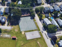
Follow directions in this directory to North Providence High School. Enter the High School parking lot and travel through the lot (on the right hand side of school while facing school) to the end of the parking lot. Take a left out of gate onto Smithfield Road, follow the road for approximately 3/10 of a mile, look for parking lot on the right hand side of the road. Soccer fields and cross country begin below the parking area and tennis is to the right above the parking area.
Note: In Poor Shape
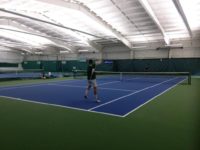
Mike Kenny Tennis Complex, Slater Memorial Park
From the North
95 South exit 29 (Broadway Downtown exit) go through first stop sign, take a right at next stop sign. After the first set of lights get into the left lane. Take a left over 95. Bear right at the stop sign and take a left onto Walcott Street. At the second light take a left onto the Industrial Highway. Take a right onto Armistice Boulevard. Go through 4 sets of lights, the entrance to the park will be on the right. The courts will be on the right after entering the park.
From the South
95 North to Exit 28 (School Street exit) At the bottom of the ramp take a left, at the first set of lights take a right onto Walcott Street, at the second set of lights take a left onto Industrial Highway. Take a right at the next set of lights onto Armistice Boulevard. Go through 4 sets of lights, the entrance to the park will be on the right. The courts are on the right after entering the park.
From North/South
From Route 95 North/South: Take Exit 10A/10 onto Rte 117 East. Follow the signs for Rte. 117 East through Apponaug. From the Lockwood Condominium site (on the right), proceed on Rte. 117 East to Wildes Corner (Herb’s Sunoco on the right, Citizens’ Bank on the left and a car dealership in the center). Stay to the right and the school is 1/2 mile on the left.